

KXRE Services & Amenities
KXRE Pilot Information
Everything you need to plan your flight to and from KRXE — airport data, runway info, frequencies, approaches, and useful links.
� Verify Before Flight
All airport data should be verified against current FAA publications, AirNav, or your EFB prior to flight. NOTAMs may supersede information on this page.
Airport Data
Field | Value |
|---|---|
ICAO Identifier | KRXE |
FAA Identifier | RXE |
Airport Name | Rexburg-Madison County Airport |
City / State | Rexburg, Idaho |
Field Elevation | 4,862 ft MSL |
Airport Type | Public Use, Non-Towered |
ASOS Frequency | 135.075 MHz |
ASOS Phone | (208) 356-0986 |
CTAF / Unicom | 122.8 MHz |
FBO — Rexburg Air Service | (208) 356-9960 |
FBO — Copter Doctor Plus | (208) 351-6703 |
Airport Manager | (208) 359-3020 |
Airport Email | keith.davidson@rexburg.org |
Emergency | 121.5 MHz (Guard) |
Approach / Departure | 128.35 MHz (Salt Lake ARTCC) |
Fuel Available | 100LL, Jet-A |
FBO Hours | Mon–Fri 8AM–5PM, Sat 9AM–3PM |
Traffic Pattern | Left traffic — Runways 17 and 35 |
Sectional Chart | Salt Lake City Sectional |
FAA Chart Supplement | Northwest Supplement |
Special Procedures | Special takeoff minimums and departure procedures apply — see Chart Supplement |
Runway Data
Runway 17 / 35 | |
|---|---|
Length | 4,204 ft |
Width | 75 ft |
Surface | Asphalt — Good condition |
Traffic Pattern | Left traffic — both ends |
Lighting | Verify with airport (MIRL standard) |
RWY 17 Threshold | Displaced threshold 302 ft — LDA 3,900 ft |
RWY 35 Threshold | No displacement — LDA 3,900 ft (full length) |
Approaches (RWY 35) | RNAV (GPS) RWY 35 · VOR RWY 35 |
Pattern Altitude | Verify in Chart Supplement (approx. 5,860 ft MSL) |
Airport Address:
296 North Airport Road
Rexburg, ID 83440
Contact Information
Craig Frisby, Manager: 356-9960
Both Rexburg Air Service and Copter Doctor offer self-service fueling of 100LL and Jet A. These underground tanks are located adjacent to Rexburg Air Service. Fuel trucks are also available for aircraft fueling.
Instrument Approaches
Approach | Runway | Minimums (DA/MDA) | Notes |
|---|---|---|---|
RNAV (GPS) RWY 35 | RWY 35 | Verify on current chart | |
VOR RWY 35 | RWY 35 | Verify on current chart |
Always use current FAA approach plates from your EFB. Listed for reference only.
Weather & AWOS
AWOS-3 at KRXE
Frequency: 135.075 MHz
Phone: (208) 356-0986
Available 24 hours. Reports wind, sky condition, temperature, dewpoint, altimeter, and remarks.
Live METAR / TAF
Current decoded METAR and TAF forecast for KRXE:
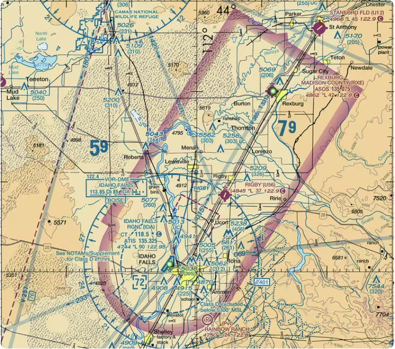
Useful Pilot Links
Frequencies, runway data, fuel prices, services, and based aircraft. The pilot’s reference for KRXE. Open AirNav →
Northwest Supplement. Contains detailed airport remarks, services, and special procedures for KRXE. Open FAA AFD →
Search current NOTAMs for KRXE and nearby airports. Always check before departure and arrival. Open FAA NOTAMs →
METAR, TAF, winds aloft, and forecasts for KRXE. Open AWC →
VFR/IFR planning, sectional charts, low enroute. Pre-loaded with KRXE as destination. Open SkyVector →
Current instrument approach procedures for KRXE from the FAA digital Terminal Procedures Publication. Open FAA d-TPP →
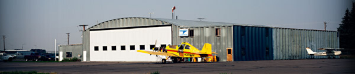
The Rexburg | Madison County Airport is a joint effort of the City of Rexburg and Madison County
and is operated under the leadership of an Airport Board.
Rexburg City Hall
(208) 359-3020
35 N 1st E, Rexburg, ID 83440
Madison County Courthouse
(208) 259-6200
134 E Main St, Rexburg, ID 83440
Contact the FBO
Rexburg-Madison County Airport
296 Airport Rd,
Rexburg, ID 83440
Phone: (208) 359-9020
Email: keith.davidson@rexburg.org
Pilot Reference
KRXE Quick Reference
Elevation: 4,862 ft MSL
Fuel: 100LL, Jet-A
AWOS: 135.075 MHz
CTAF/Unicom: 122.8 MHz
Runway: 17/35 (4,204 ft)
Full data on AirNav →